


How a Ming Scholar’s 127-Volume Encyclopaedia Mapped Knowledge Through Chinese Eyes
- InduQin
- 1 day ago
- 4 min read
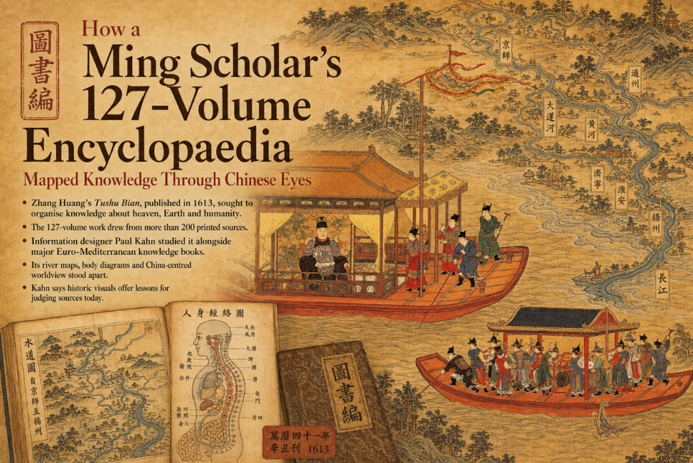
Zhang Huang’s Tushu Bian, published in 1613, sought to organise knowledge about heaven, Earth and humanity.
The 127-volume work drew from more than 200 printed sources.
Information designer Paul Kahn studied it alongside major Euro-Mediterranean knowledge books.
Its river maps, body diagrams and China-centred worldview stood apart.
Kahn says historic visuals offer lessons for judging sources today.
Centuries before search engines and digital databases reshaped access to information, a Ming dynasty scholar attempted to organise the world’s knowledge from a distinctly Chinese point of view. The result was the Tushu Bian, or Compendium of Illustrations and Texts, a vast encyclopaedic work that ran to 127 volumes.
Compiled by Neo-Confucian scholar Zhang Huang and published in 1613, the work brought together material from more than 200 printed sources collected over several decades. Its purpose was ambitious: to explain the relationships between heaven, Earth and human life through text, diagrams and illustrations.
Information designer Paul Kahn, who examined the encyclopaedia in his book Mapping Knowledge Across Time: Seven Books That Visualised the World, described Zhang’s aim as an effort to assemble the images and writings that an educated reader would need in order to comprehend the world. Kahn noted that the project was too expensive to publish while Zhang was alive and was eventually carved onto woodblocks and printed after his death.
Kahn studied the Tushu Bian alongside six other major works that visualised knowledge from the Euro-Mediterranean tradition. He selected the Chinese encyclopaedia because it offered a major visual summary of Chinese culture during a period when Asia and the West were increasingly encountering one another.
One of the most striking features of the Tushu Bian, Kahn said, is its treatment of China’s waterways, particularly the Grand Canal and major rivers. The Grand Canal, an enormous transport network, extends from Beijing southward across the Yellow River and links with canals and tributaries connected to the Yangtze River near present-day Yangzhou.
European works from comparable traditions often represented rivers and maritime routes as networks of lines linking one place to another. Kahn pointed to the Danube River as an example frequently reproduced in European books to show travel and connectivity across central and northern Europe.
By contrast, the Tushu Bian presented rivers not simply as routes or abstract networks, but as continuous sequences of detailed place descriptions. The emphasis was less on geometric mapping and more on following the river through the places and landscapes connected to it.
The encyclopaedia also departed from modern mapping expectations. Rather than consistently using a bird’s-eye perspective or placing north at the top, its river illustrations often run horizontally from right to left, regardless of actual compass direction.
Kahn said such differences show how orientation depends on cultural convention. Readers trained to expect north at the top may struggle to recognise or interpret a map arranged according to another visual logic. He added that contemporary mobile mapping applications have, in some ways, reintroduced flexibility by adjusting displays according to the user’s needs.
The Tushu Bian also stands out for the way it depicts the human body. In Zhang’s encyclopaedia, the body is shown as a channel through which primordial qi, inherited from one’s parents, connects heaven and Earth. The work includes detailed diagrams of internal organs and bodily systems.
Kahn observed that few of the other books he studied presented the body as connected to the natural world or as a microcosm. One exception was the 14th-century Catalan Atlas, which included a human figure linked to astrological information and numerical guidance for bloodletting, a common medical practice at the time.
In the Tushu Bian, one medical diagram places internal organs inside a pear-shaped outline while representing the spinal vertebrae as bones. Another shows the spine as a chain of circles connected to the head. Kahn suggested that the side-view arrangement may have been chosen to highlight the spine and spinal column, reflecting a tradition in which different spinal locations were associated with different organs.
Beyond its visual richness, the encyclopaedia also served practical educational purposes. Kahn said Zhang compiled the material partly for the benefit of his students. It could also assist those preparing for the imperial examination system, the rigorous route into government service. Candidates often spent many years studying for the exams, and those who failed still formed a large portion of the literate population.
Yet the Tushu Bian also reveals what its compiler chose not to emphasise. Despite being produced during the Ming era, it makes no reference to the seven great maritime expeditions led by Admiral Zheng He between 1405 and 1433. Instead, its world maps focus heavily on the Chinese Empire and provide only limited depictions of surrounding tribute states.
Kahn noted that the most detailed treatment of the outside world appears in areas where China faced threats or defended itself against invasion. He said the omission of Zheng He’s vast naval voyages suggests that Zhang made deliberate choices about what knowledge his intended readers should consider important.
For Kahn, the study of works such as the Tushu Bian carries lessons beyond historical scholarship. He said readers today should pay close attention to where information comes from, whether examining centuries-old visualisations or navigating AI-generated content and deepfakes.
Understanding whether a source is based on direct observation, copied material or second-hand accounts remains essential, he said. As an example, Kahn pointed to the Atlas Historique, published in Amsterdam in the 18th century, which included images of India’s Mughal Empire copied from the personal art collection of an Italian diplomat. Those works had reached the Netherlands through Dutch East India Company traders from India and China.
Because the images were copied from paintings made in India, Kahn said they carried a greater degree of authenticity than many European-created depictions of Asian people. Compared with images of Japan and China produced through a more European lens, the Mughal illustrations appeared less Europeanised.
The broader lesson, Kahn said, is to study images critically and consider how close they are to their original sources. The Tushu Bian, with its maps, body diagrams and selective worldview, remains a powerful example of how knowledge is not only collected but also arranged, interpreted and shaped by culture.


Comments